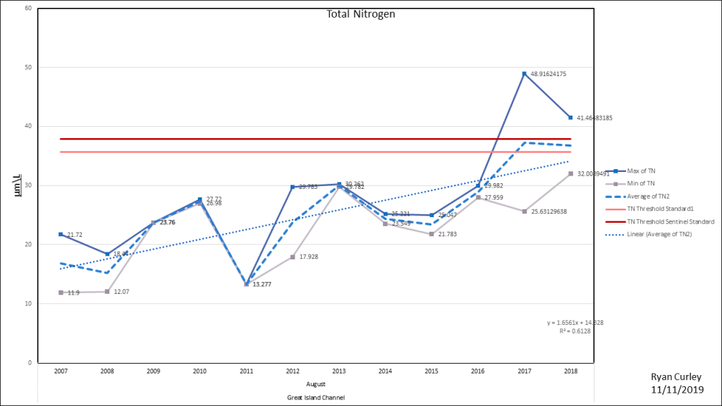
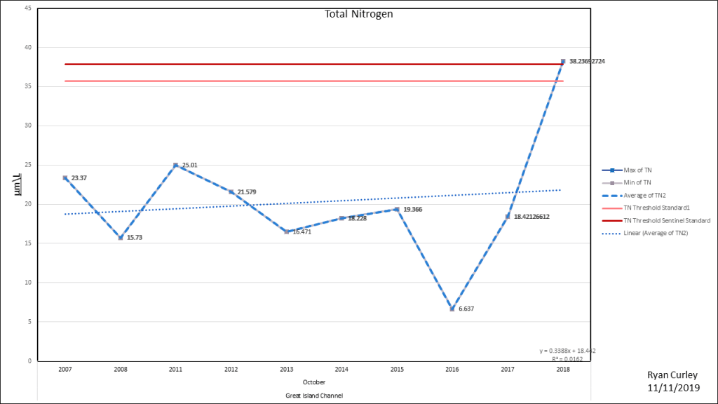
The water quality of Wellfleet Harbor has steadily deteriorated since 2007. Total Nitrogen and concentrations have steadily increased across the entire harbor system. This is the first of a three part series on water quality. This post is showing total nitrogen concentrations. All data is directly from the Center for Coastal Studies. Click here for Chlorophyll concentrations.
Wellfleet Harbor has nine locations where water sampling is carried out by the Center for Coastal Studies. The sampling season is typically May through October, with the exception of the Herring River where year round sampling started in the fall of 2017. May and October typically have one water sample taken per station. From June though September there are typically two samples taken per station. Water conditions vary greatly by month. Nitrogen concentrations typically are highest during the summer. To compensate for the variability water quality has been broken out by station and month.
Understanding these charts:
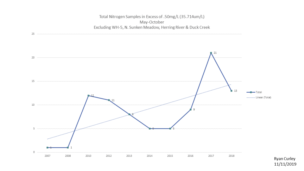
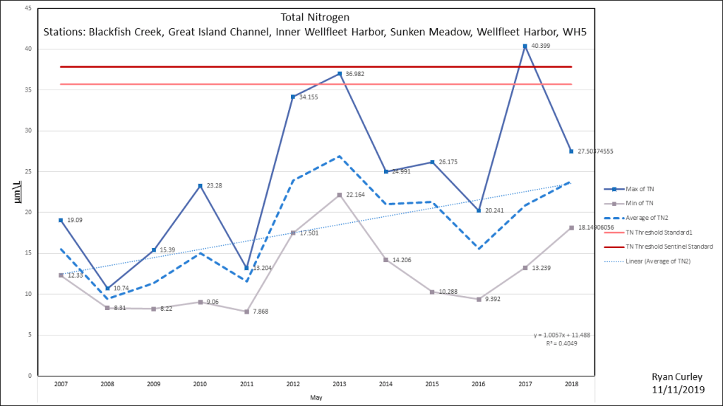
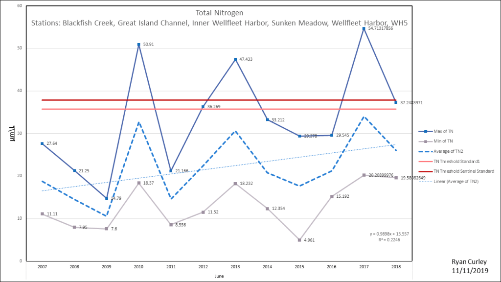
In general Total Nitrogen(TN) concentrations in excess of .50 mg/L are indicative of a nitrogen impaired water body. The center for Coastal Studies measures TN in micro-moles (μm). The Massachusetts Estuary Project (MEP) set the acceptable nitrogen concentrations for Welfleet Harbor. The threshold level for MEP for some parts of the Harbor is .53 mg/l which corresponds to a value of 37.86 μm/l other parts of the harbor threshold is .50mgl (35.71μm/l) which is the standard level when measuring eutrophication. For the sake of making this measurement easier to understand it is displayed as μm/L (micromoles per litter). This is redundant as μm is the same as μm/L. However μml/L is more accessible to a layperson because it provides a point of reference. These graphs use a light red line that represents .50mg/l and a dark red line for .53mg/l.
The formula for converting nitrogen measured in um to mg/l is : (μmTN x (14g/1000))=TN mg/l. Note μm is a measure of molar mass as such the conversion changes based on the mass of the element or molecule being measured, 14g is the molar mass of N. There are other isotopes of N but they exist in minute amounts and do not materially effect the molar mass when converting from um to mg/l.
Sections:
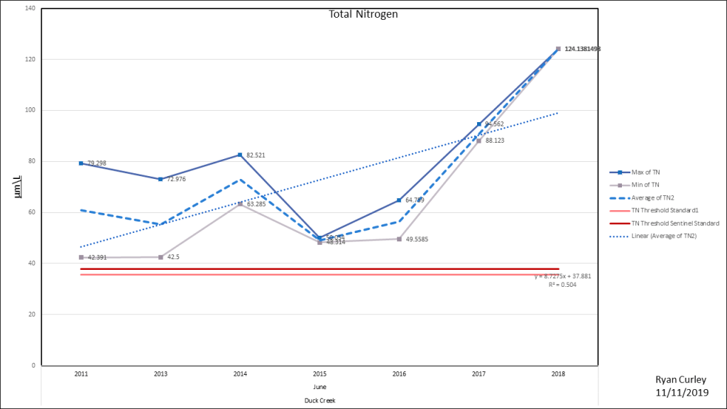
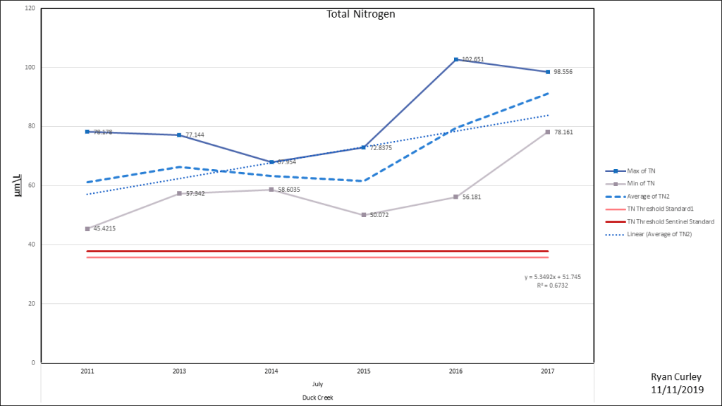
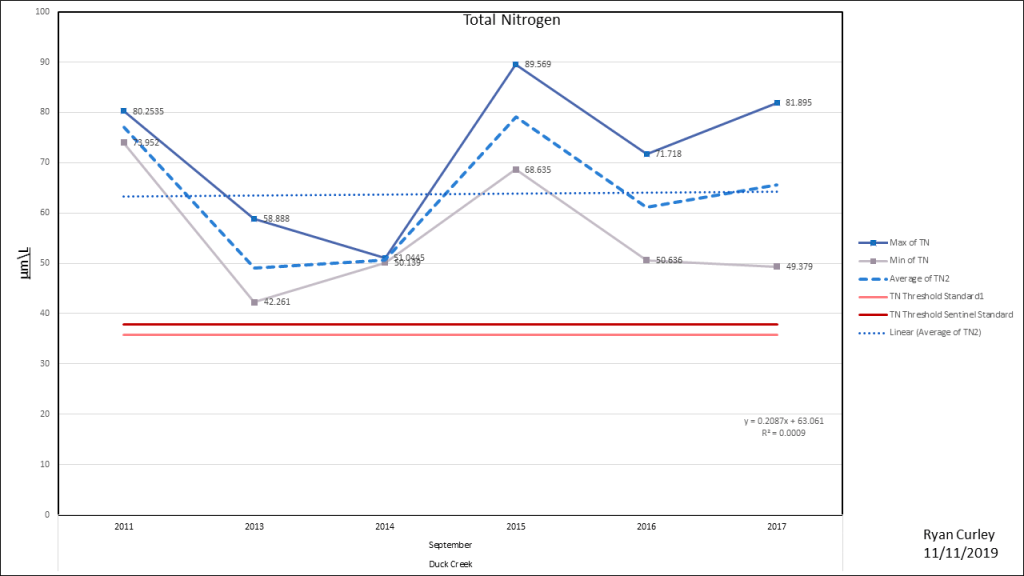
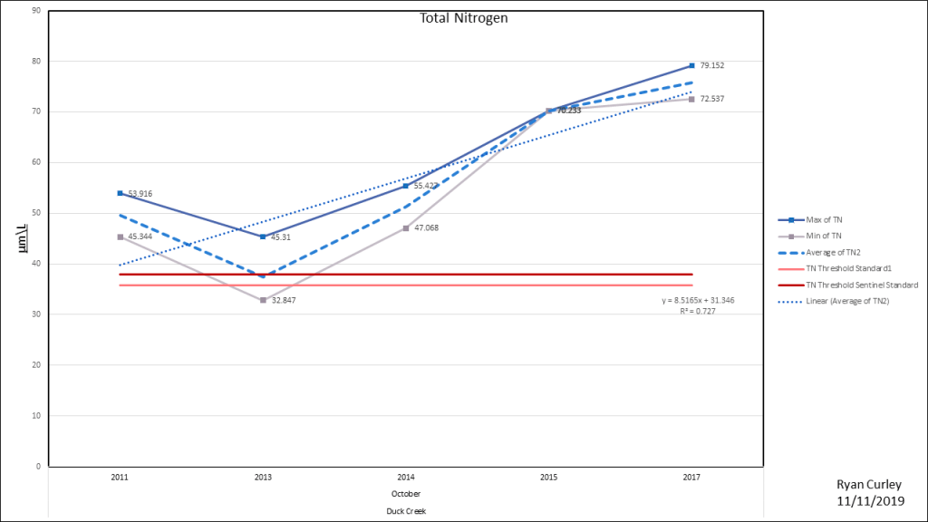
Duck Creek
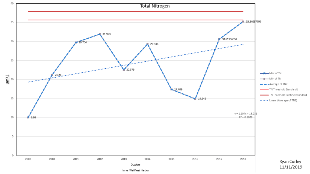
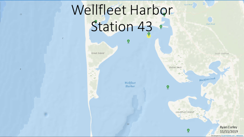
Inner Wellfleet Harbor
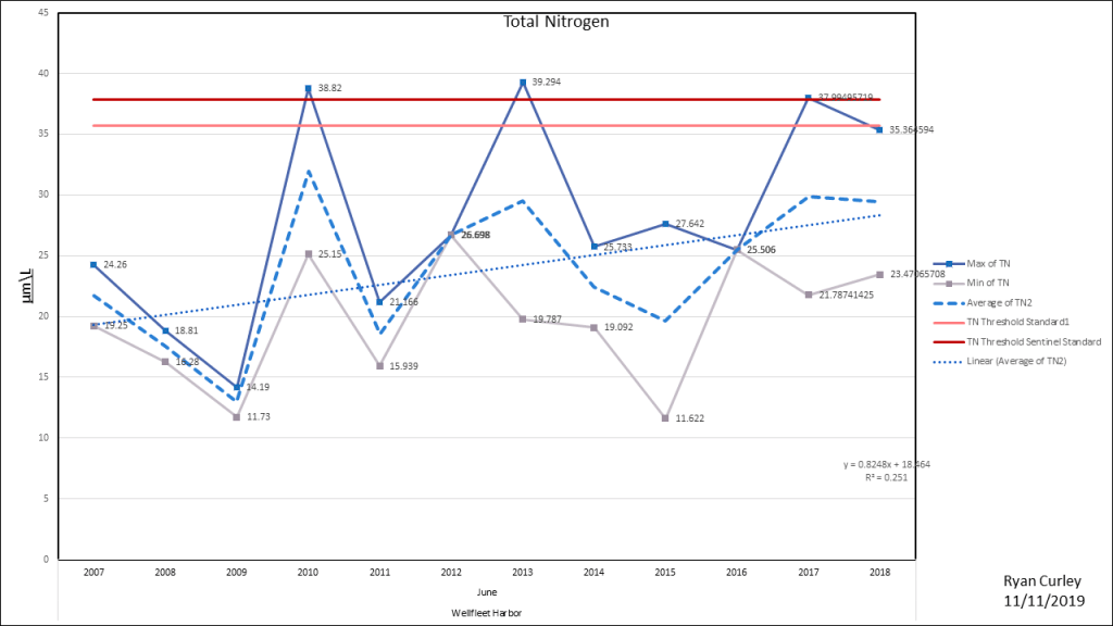
Wellfleet Harbor
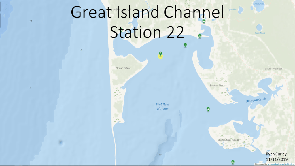
Great Island Channel
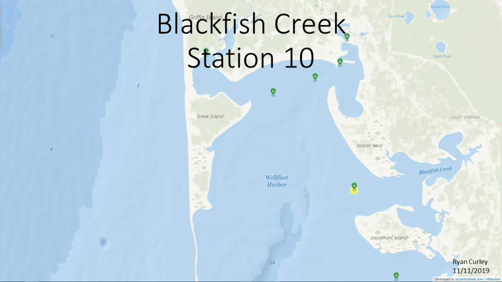
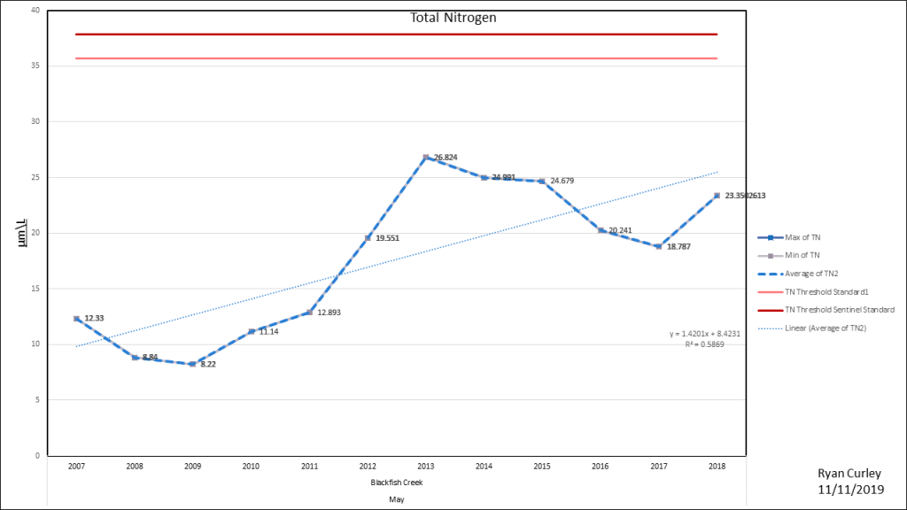
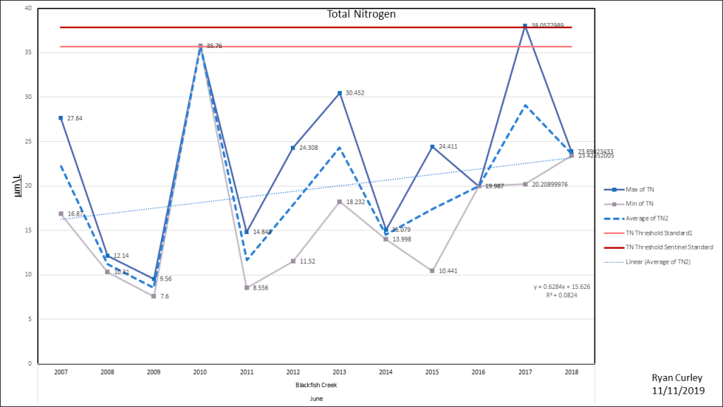
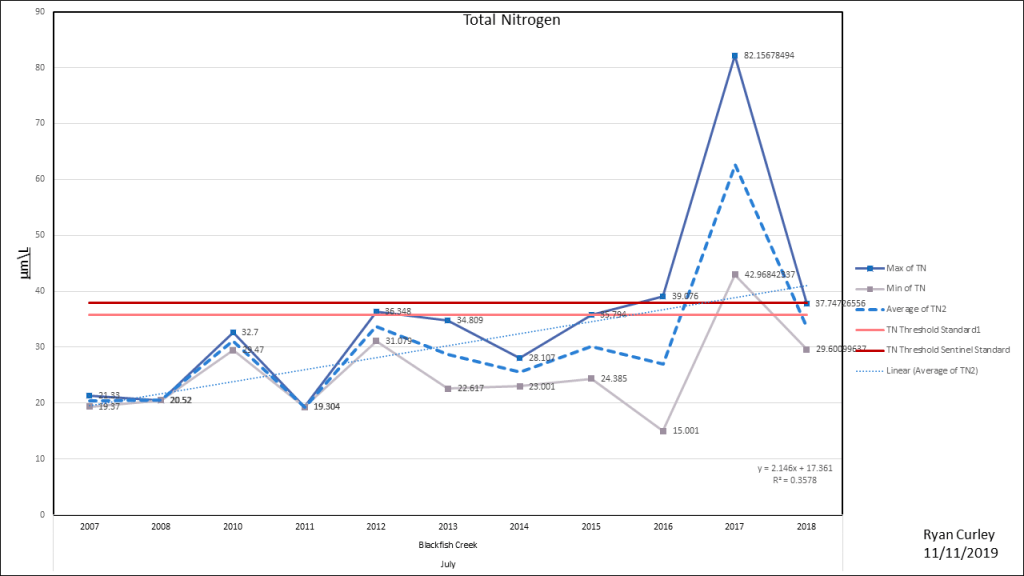
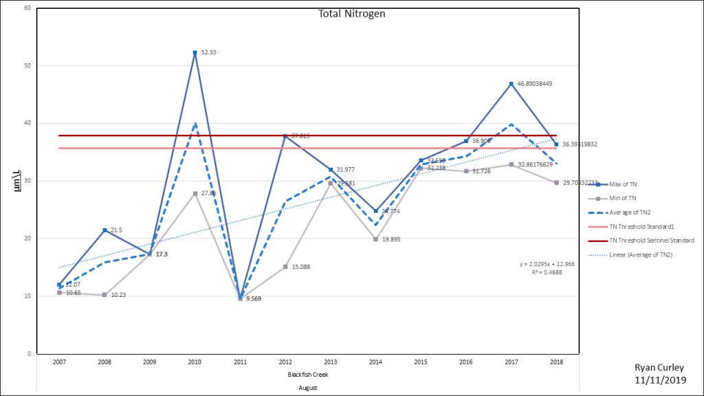
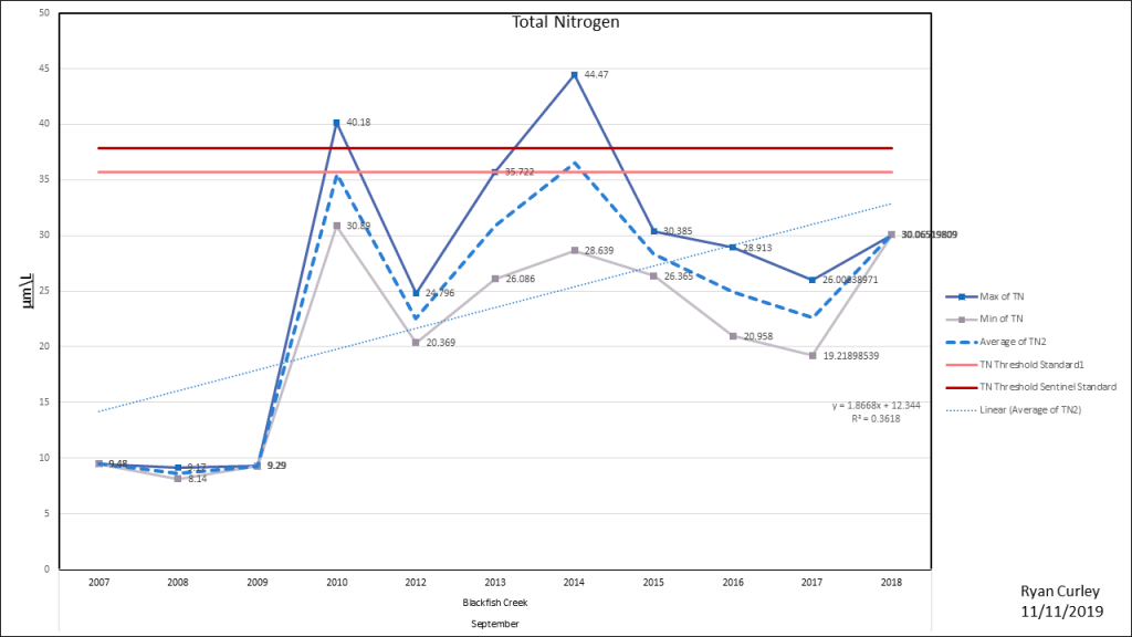
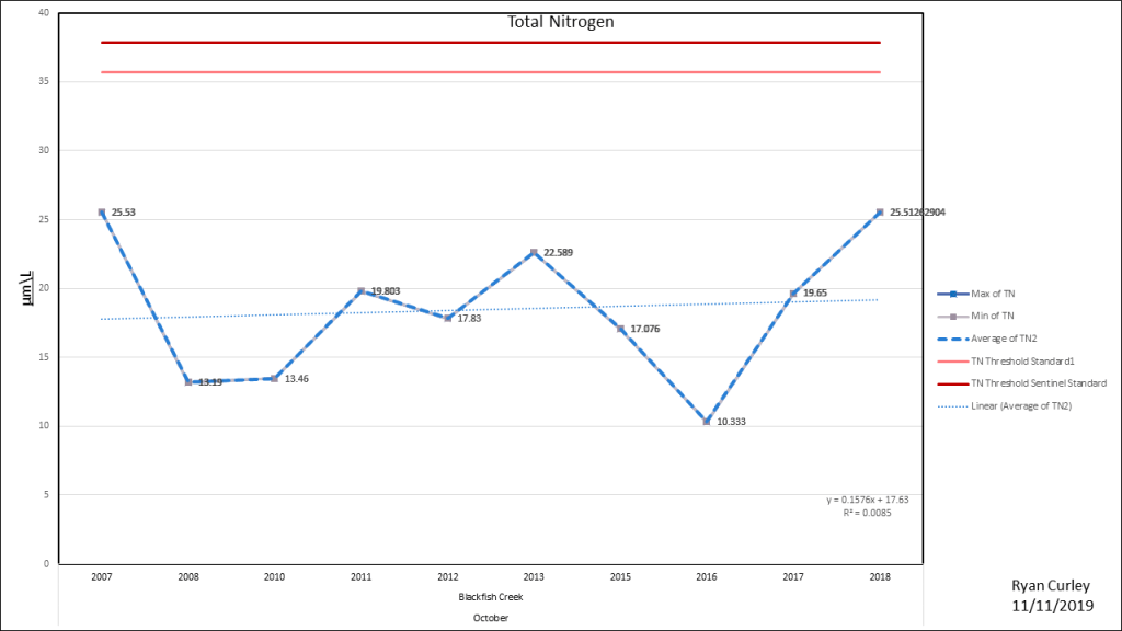
Blackfish Creek
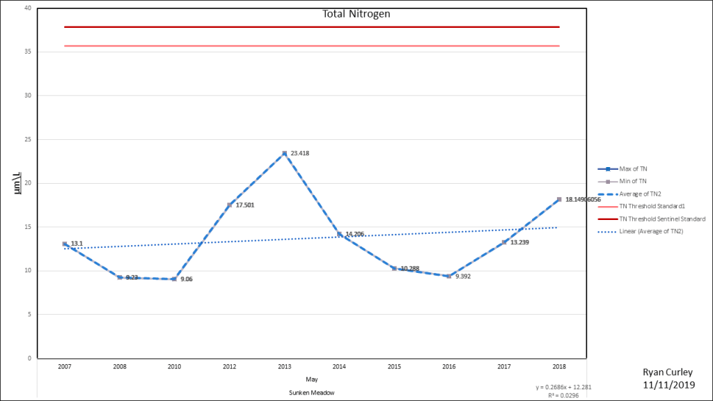
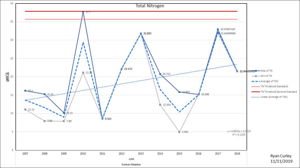
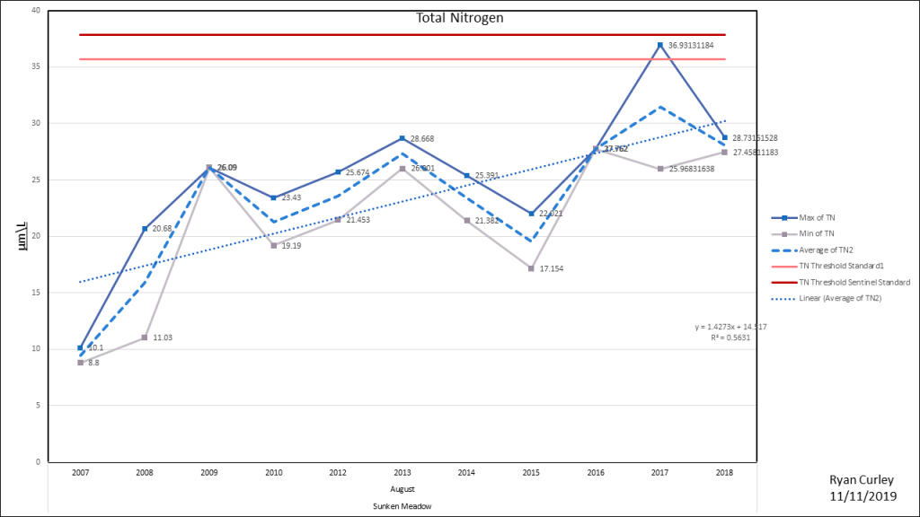
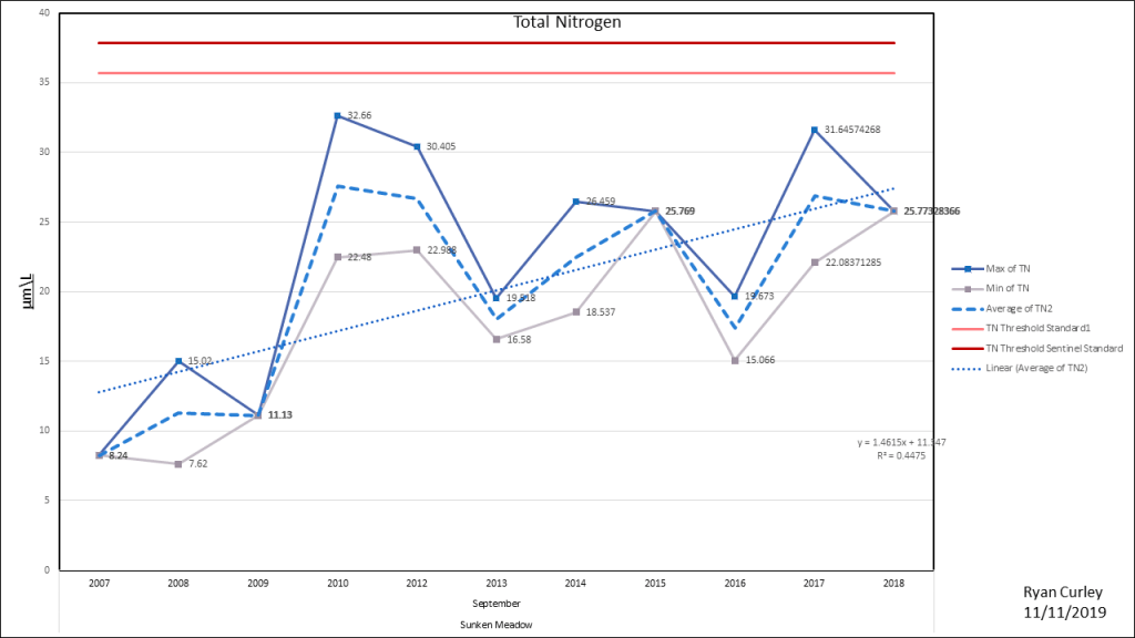
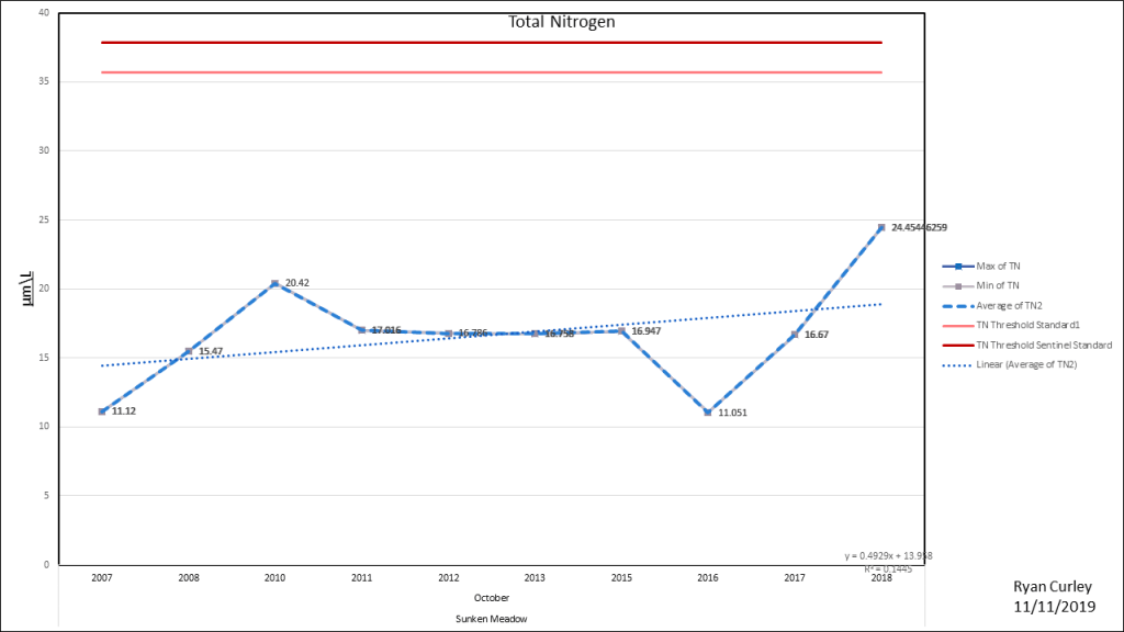
Sunken Meadow/ South Lt. Island
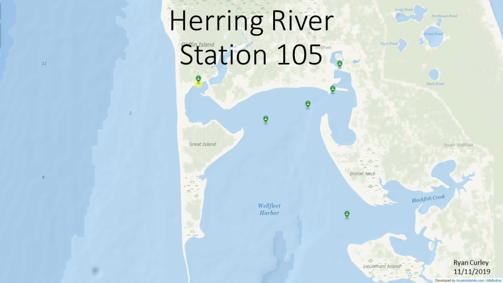
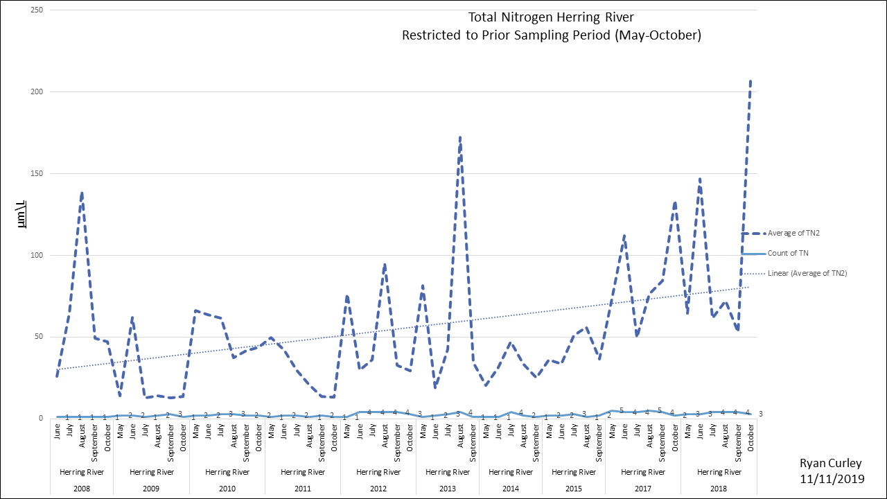
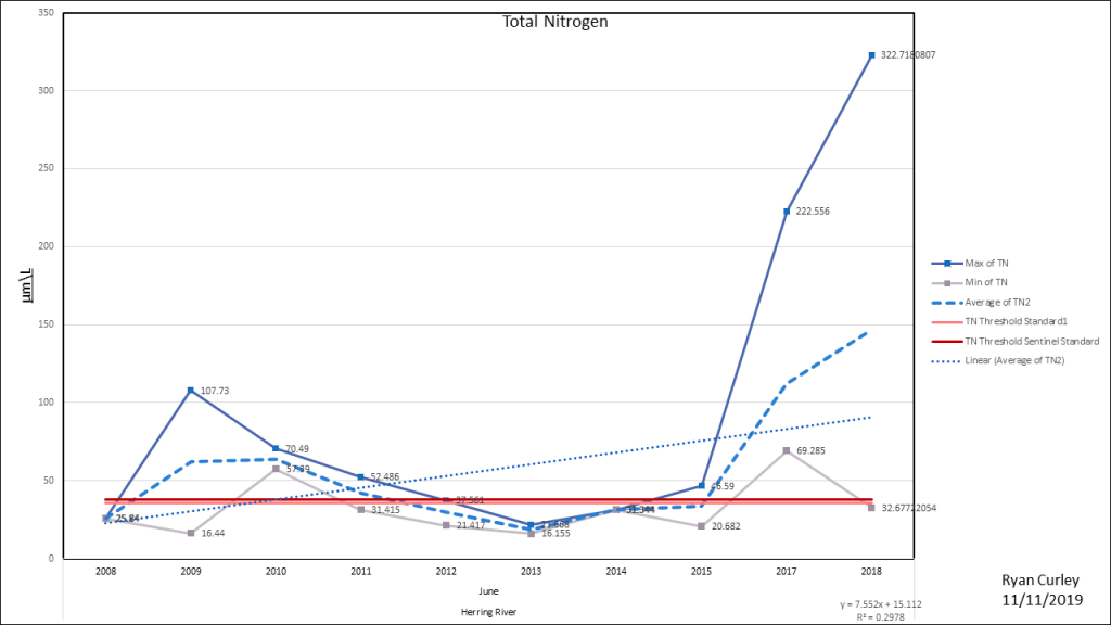
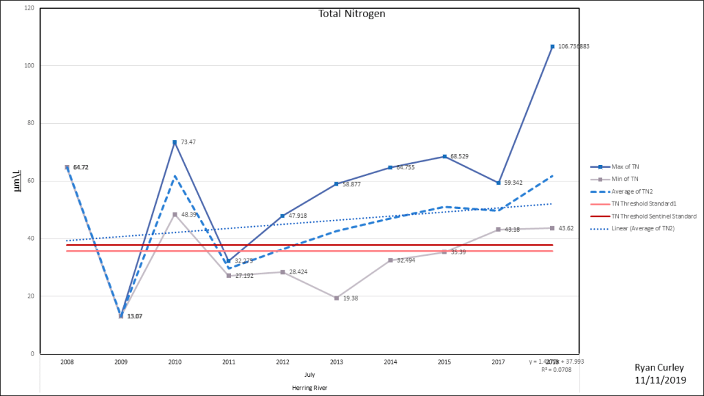
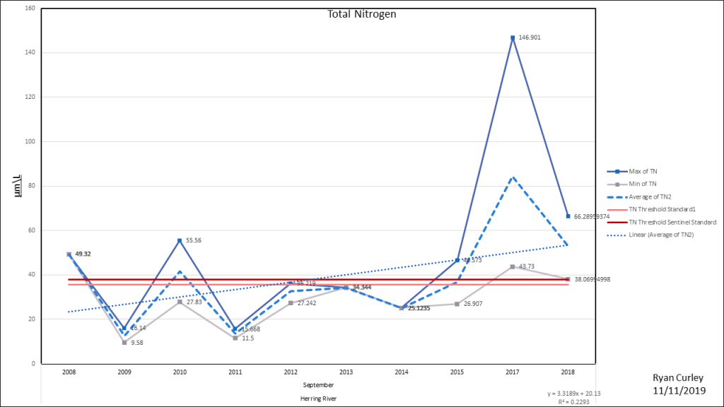
Herring River
Cape Cod Bay Station 5S

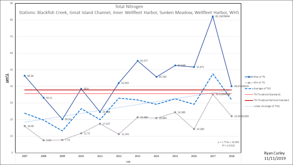
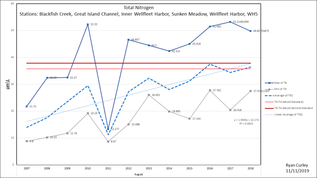
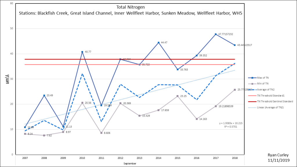
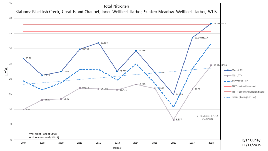
Wellfleet Harbor Composite
To produce a larger sample size it was necessary to combine the results of multiple stations. Wellfleet Harbor Composite is the combined data of Blackfish Creek, Great Island Channel, Inner Wellfleet Harbor, Wellfleet Harbor, and Outer Sunken Meadow (directly south from Lt. Island). It most accurately reflects the water quality of Wellfleet Harbor as a whole. WH5 station’s data starts in 2017 so it is included in the Composite only where it will not skew the results so it is used for averages but not for counts. Duck Creek, Herring River and N. Sunken Meadow stations are not used in the composite because the results from those stations are consistently higher in nitrogen than the other stations and have wider oscillations.
Duck Creek (Old RAILROAD Bridge)

Duck Creek is one of the most heavily impacted water bodies in the Wellfleet Harbor embayment. The sampling station is at the old railroad bridge.


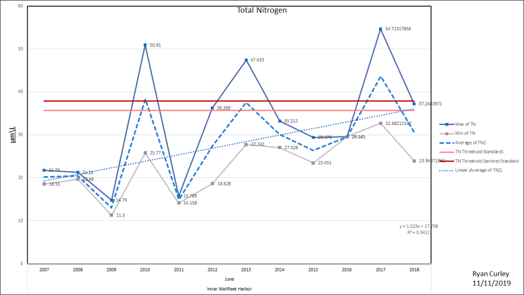
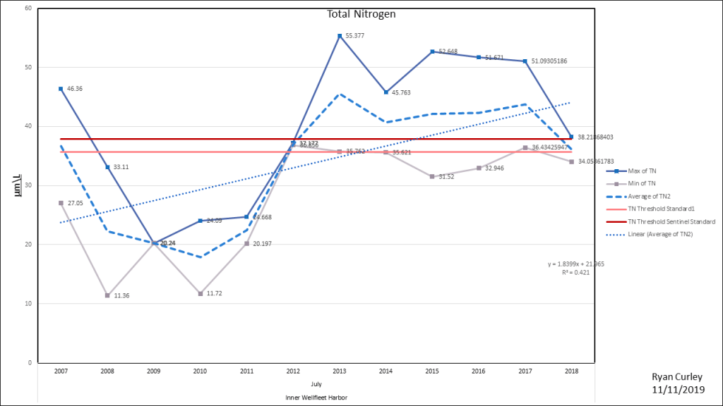
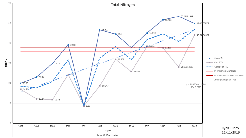
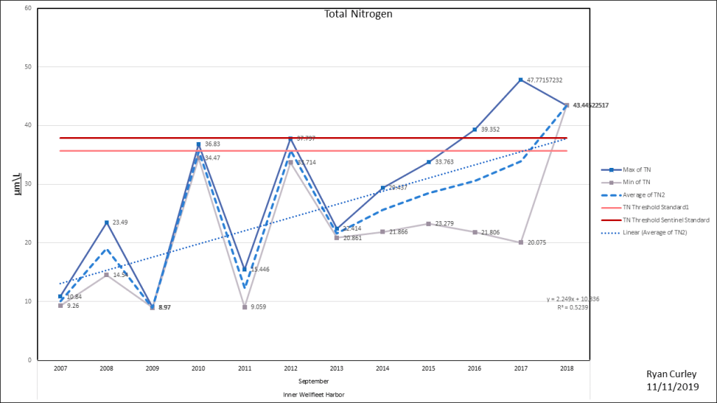
Inner Wellfleet Harbor
(Wellfleet Fish Pier)


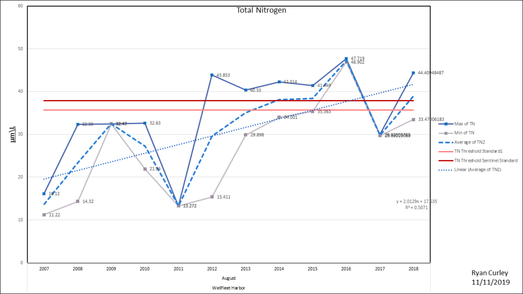
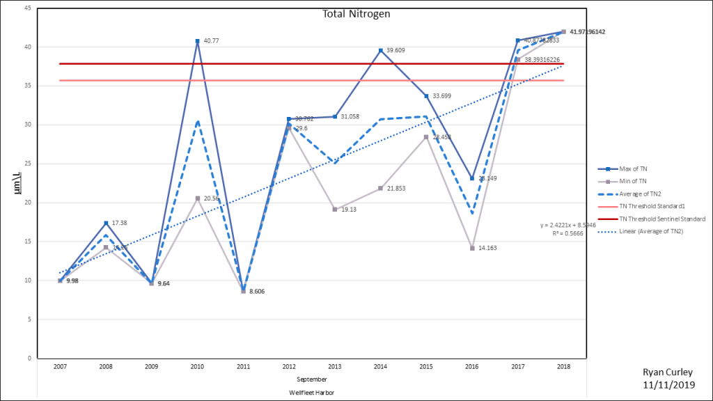
Wellfleet Harbor
NW of Breakwater
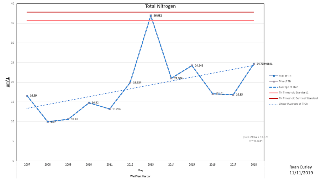

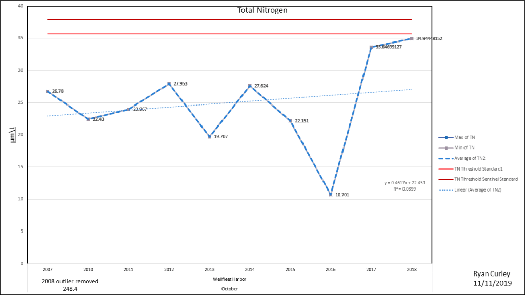
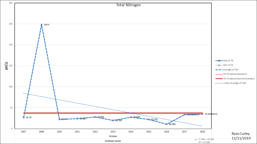
There is a major outlier in October 2008
Great Island Channel
Near Old Saw


BlackFish Creek
Sunken Meadow
sOUTH OF lt. iSLAND


Herring RIver


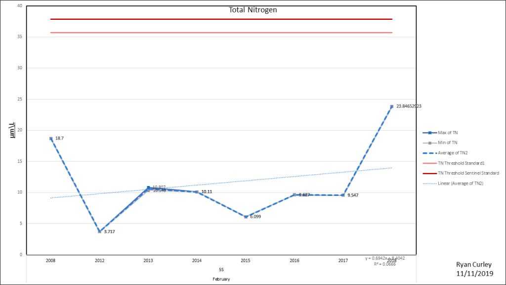
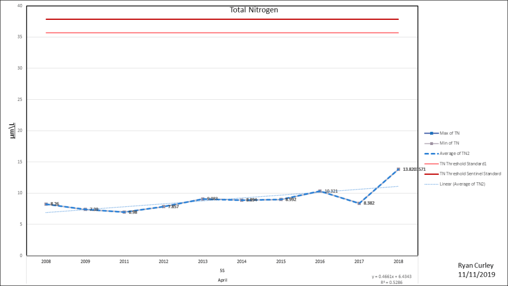
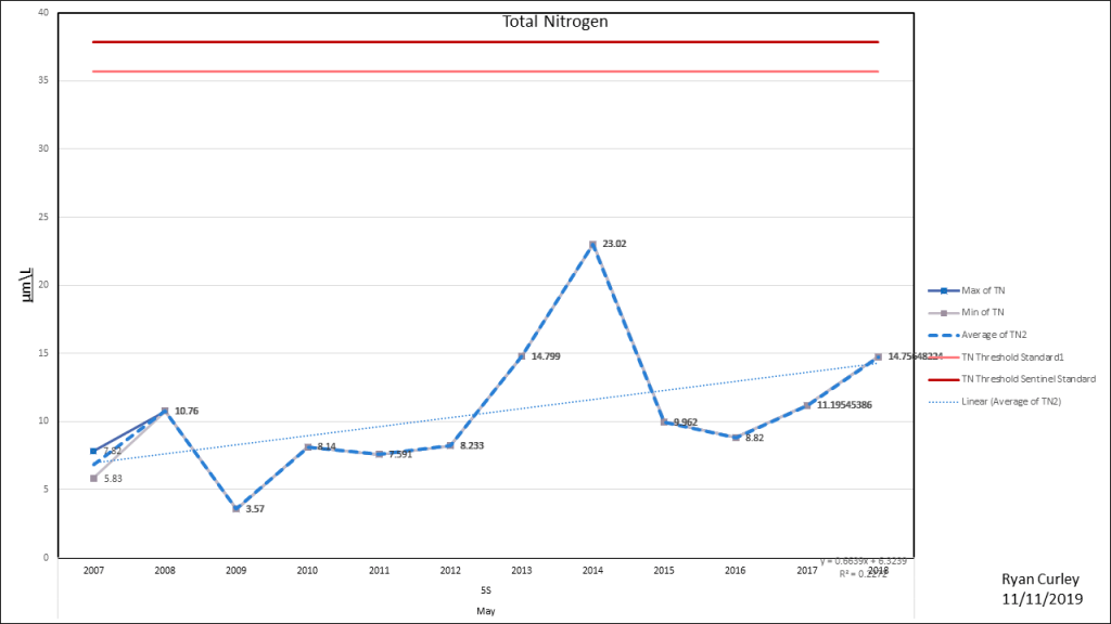
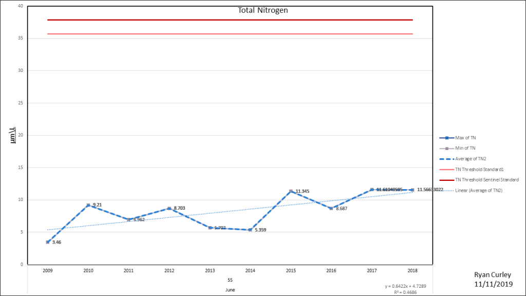
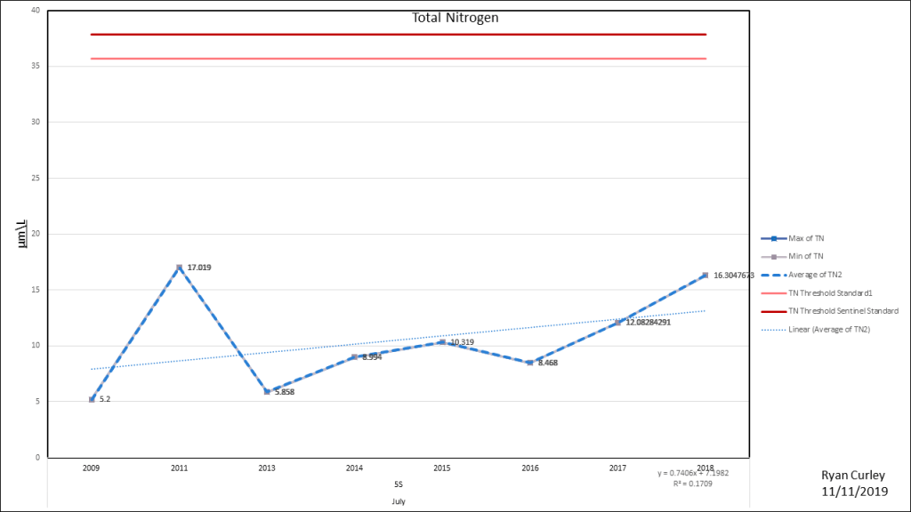
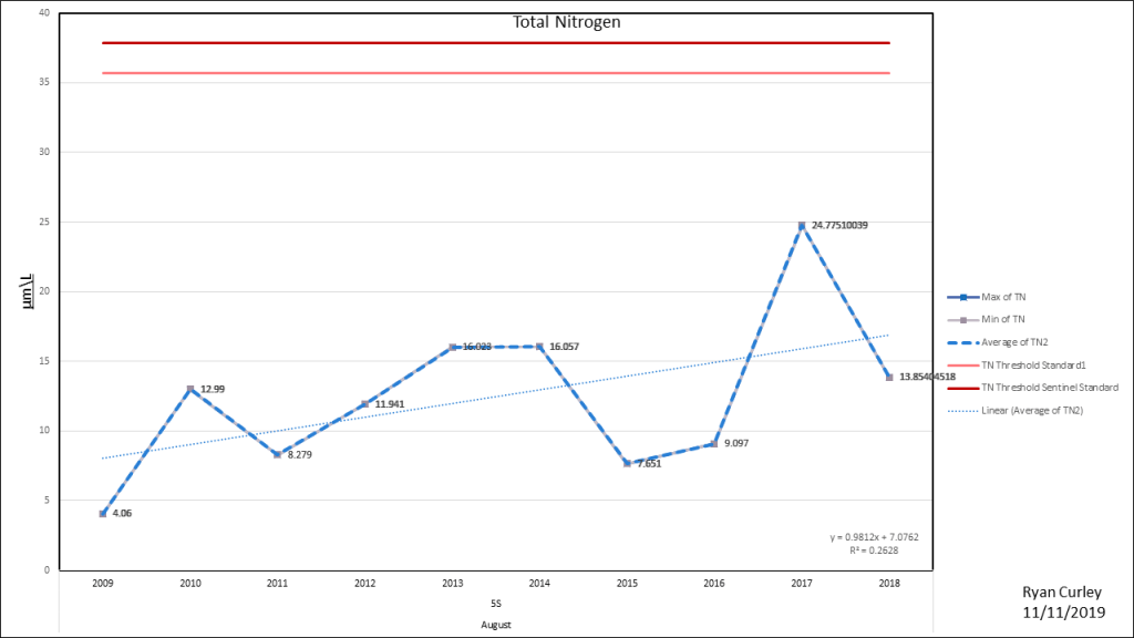
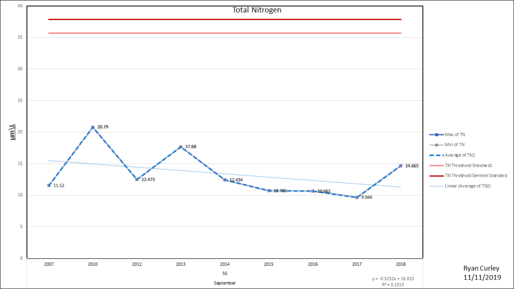
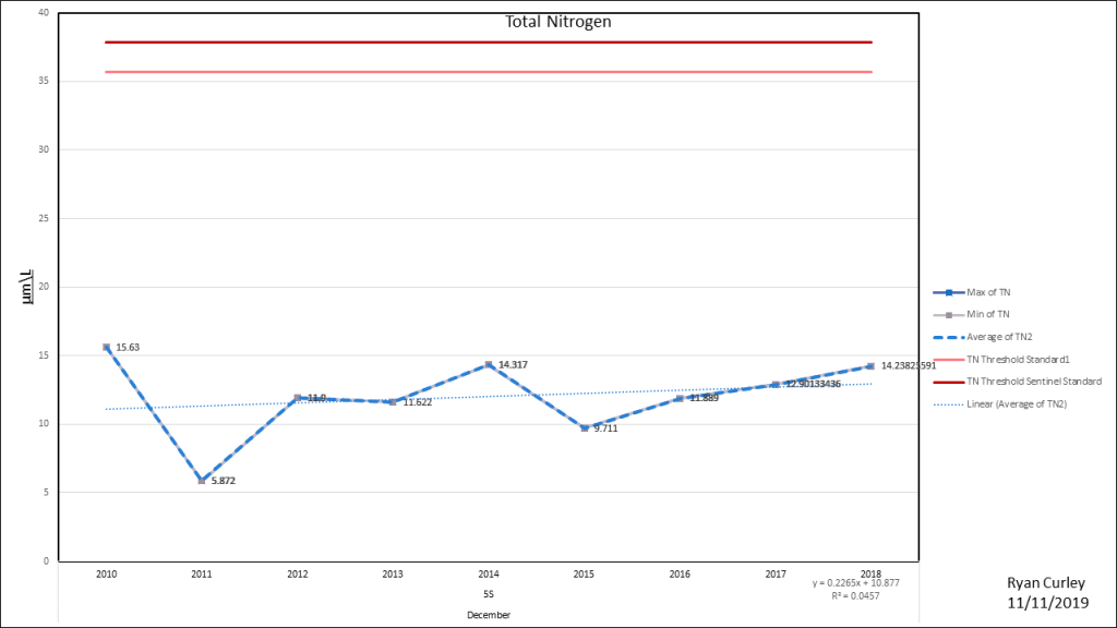
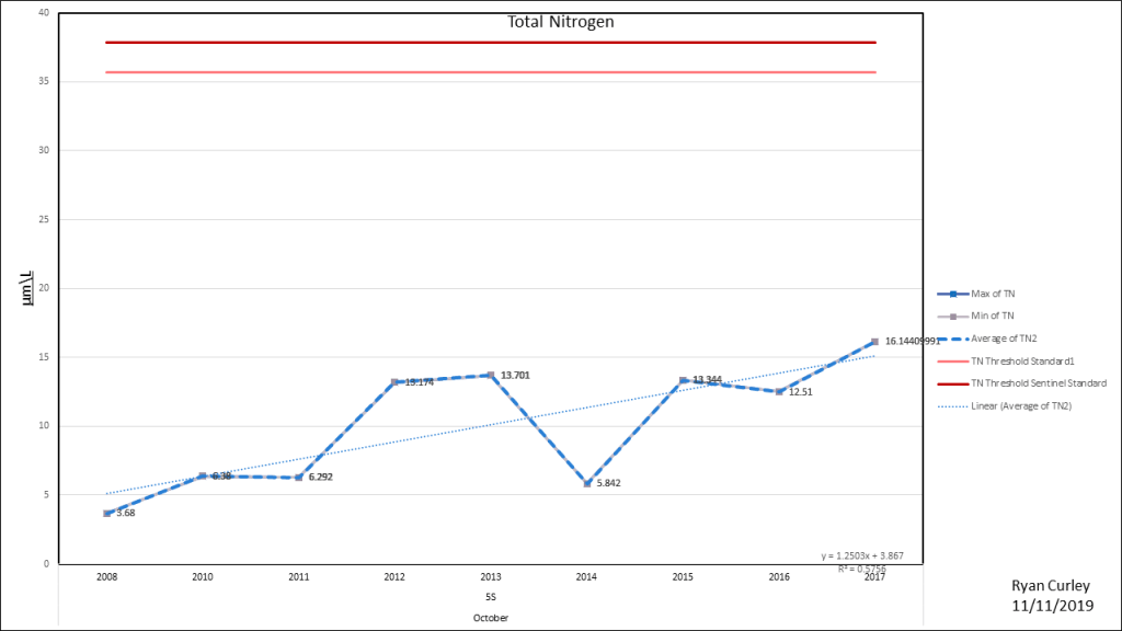
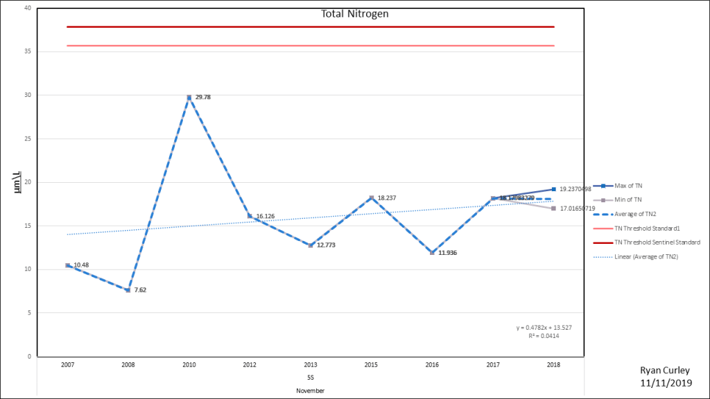
Cape Cod Bay Station 5S
Due West of Great Island

CCB 5S is the closest Cape Cod Bay monitoring station. The Center for Coastal Studies offshore stations are sampled on year round basis. Generally it is assumed that the offshore waters are the baseline in terms of nitrogen concentrations. The Massachusetts Estuary Project assumes that the offshore water is a steady state. The TN concentrations offshore are not in a steady state and are slowly increasing. This directly impacts the nitrogen concentrations in Wellfleet Harbor because this is the water that flows into the water body.


Great info
So how long before Wellfleet
starts to construct a fresh water
treatment area, as what Orleans
Ma. Is currently going through?
Are we in Wellfleet destined
To have a sewage treatment
plant in our National Seashore
Park?
LikeLike
I can not answer any of these questions definitively. I will continue to push for action soon. Wellfleet’s wastewater plan is unsettled. As of now, it is unlikely that a sewage plant would be located within the seashore. I recommend looking at the most recent concepts. https://www.wellfleet-ma.gov/comprehensive-wastewater-management-planning-committee/pages/power-point-presentation-from-scott
LikeLike